On July 22, 1796, Moses Cleaveland and a party of surveyors employed by the Connecticut Land Company arrived at the site of what today is Cleveland, Ohio—thus marking July 22 as Cleveland’s birthday.
Beyond establishing the city Case Western Reserve University calls home, that date marked the formal start of the transformation of Northeast Ohio’s natural landscape.
In honor of Cleveland’s upcoming 227th birthday and to learn more about its founding, The Daily sat down with John Grabowski, the Krieger-Mueller Joint Professor in History at the College of Arts and Sciences. Grabowski is an expert in all things Cleveland, and oversees the online edition of The Encyclopedia of Cleveland History.
Read on to gain Grabowski’s insights—and make a plan to attend Cleveland’s birthday bash on July 22!
1. Moses Cleaveland had no intention of personally settling in the area.
Moses Cleaveland and the members of his party were agents of the Connecticut Land Company, and their task was to survey the lands of Connecticut’s “Western Reserve” in order to make them available for sale. It was a real estate deal—not a settlement project, and Cleaveland was one of the major investors in the Connecticut Land Company which had purchased the Western Reserve from Connecticut for $1,200,000.
The survey would take two years to complete, but Cleaveland was here only for the first year. He and almost all of his survey party would return to Connecticut in the autumn of 1796. Yet what they began changed the way the land was viewed and used.
2. Cleaveland did not come to an unsettled or unknown land.
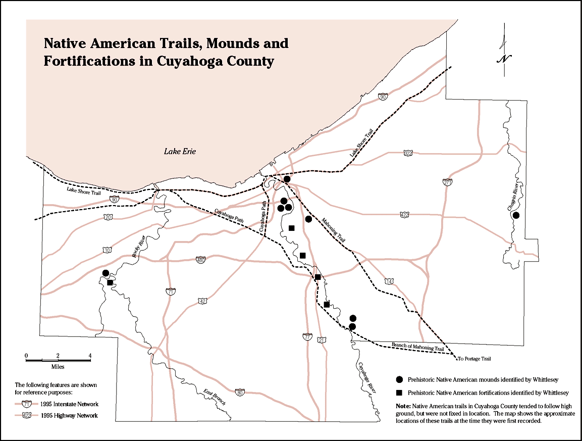
The area had seen nearly 12,500 years of human habitation, some nomadic and some permanent. The Native Americans who were the first settlers made only minor marks on a landscape that had been shaped by geology and time. They created trails, riverside settlements and burial mounds. The mounds were already ancient by the time Cleaveland arrived, yet they signified a deeper history than that which some people commonly assume.
Their relationship with the land was governed by natural features—waterways, hills, ridgelines and salt licks. It was a heavily forested landscape with an abundance of game with small open fields for planting. That manner of viewing and utilizing the landscape would begin to “end” with the Treaty of Greenville in 1795, when the native peoples lost possession of the lands east of the Cuyahoga River. That’s what “allowed” Cleaveland to begin his survey of the land the following year.
3. The survey Cleaveland and his party used focused on dividing the landscape into a grid of townships.
Each township consisted of 25 square miles of land and each was bounded by lines running east to west and north to south. It represented an imposition of the rational over the natural. The townships were key to the sale of the land. Today, property title searches in Northeast Ohio trace ownership back to the parcels defined by Cleaveland’s surveyors.
Cleveland was surveyed early in the process. It was, of course, the site where the Moses Cleaveland and the surveyors landed on July 22—traveling by boat, they disembarked at the site where St. Clair meets the Cuyahoga River. Moses Cleaveland would soon determine that the area where the Cuyahoga flowed into Lake Erie was the most appropriate place to headquarter the survey party. The river and lake allowed relatively easy access to the interior of the Western Reserve for his surveyors.
4. The surveyors suggested that the city be named after Cleaveland.
But, according to one historian, Cleaveland initially felt that it should be named after the river, Cuyahoga—which is believed to be of Native American origin. Of course, this matter brings up the perennial question of when and why did the spelling of the city’s name shift to the current “Cleveland?” Actually, both spellings can be found in early documents and maps. Officially, the current spelling was evident in the state-issued documents that recognized the community as a village in 1814 and a city in 1836.
5. In laying out the town, the surveyors created a particular cultural signifier that evidenced their idea of what the new community would be.
They structured the plan of Cleveland around a town square, something that was common in New England—thus envisioning a community that would become a replica of the towns they knew in the east. Around the town commons they laid out small lots for the homes and businesses, beyond the immediate center the property parcels became larger, envisioned for farming.
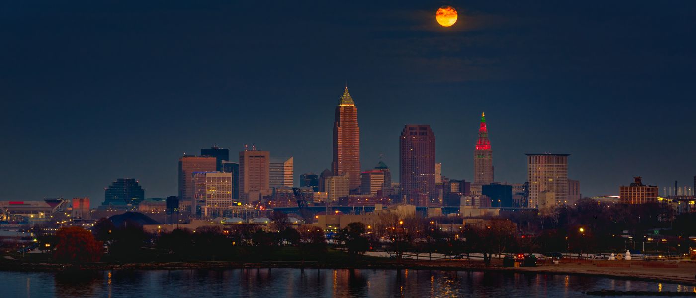
Today, Public Square reflects upon the concept of what Cleveland would be. Indeed, upon returning to Connecticut later in 1796, Cleaveland reported to the Connecticut Land Company that the town that now bore his name would one day be as large as old Windham, Connecticut, then a town of about 2,700 people. Now, 227 years later, the size and diversity of Cleveland is far beyond anything that Moses and his surveyors could have envisioned
6. Reminders of Cleveland’s past are still evident throughout the city.
Certainly the Public Square endures, but an even older history is reflected in some of the highways and roads that don’t seem to fit the grid: A good number follow the paths of the Indigenous peoples—the ridge roads that parallel the lakeshore follow Native American trails; and Euclid Avenue (once known as the Buffalo Road) shares a distant origin, as do parts of Broadway which was part of the Portage Path. All of these serve to remind us that there was a land, a landscape and a people here long before Cleaveland arrived.