


Geology is more than just studying rocks—it’s about understanding the history of our planet, from shifting continents to ancient climates. For two Case Western Reserve University students, Patricia Carrig and Takele Mihretie, this field has taken them from classrooms to remote landscapes, where they’re uncovering clues about Earth’s past through hands-on research.
From the arid landscapes of Death Valley to the fossil-rich terrains of Ethiopia’s Afar region, their fieldwork is on the frontlines of geological discovery.
In recognition of National Geologist’s Day, celebrated annually in April, The Daily spoke with Carrig and Mihretie about their experiences in the field and what drew them to geology.
Patricia Carrig
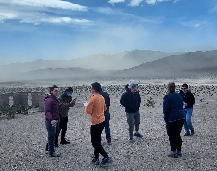
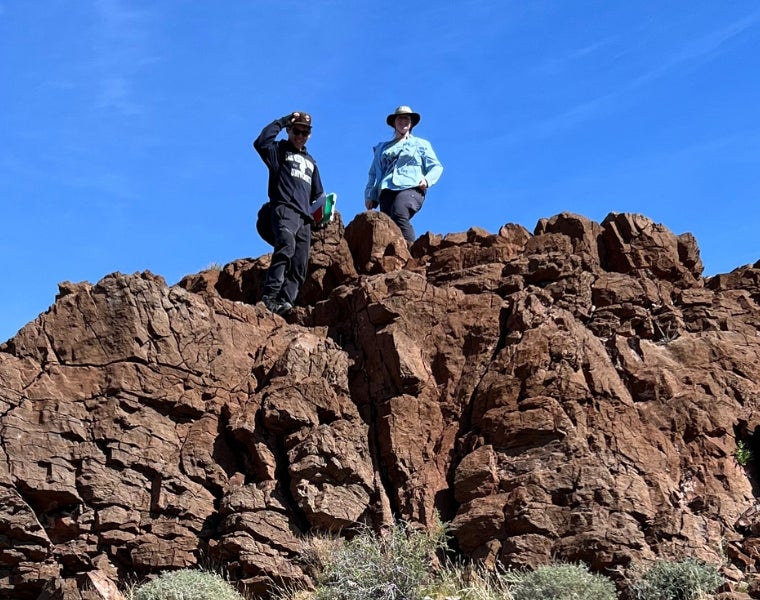
Patricia Carrig, a fourth-year student studying environmental geology and environmental studies, was introduced to the power of fieldwork during a spring break trip to Death Valley.
“Being able to see the exposed stratigraphic units so clearly on the sides of the mountains in the desert was crazy,” Carrig said. “I’m from the East Coast, where a lot of our stratigraphy is covered up by vegetation and sediment, and I had never seen anything like that before.”
Originally considering studying engineering, Carrig shifted her focus to geology after taking an introductory course at CWRU. She was drawn to the problem-solving aspects of the field and the opportunity to apply scientific methods outside the lab.
Her current research in geochemistry focuses on chromium diffusion in iron meteorites, helping to answer questions about planetary formation. But for Carrig, fieldwork remains a highlight of her academic experience. During a weeklong camping trip in Death Valley, she and her classmates hiked daily to map rock formations, applying skills learned in class to real-world geological puzzles.
“Trying to understand the formations we were seeing was difficult, but it was so cool to get real-world experience for the methods we’d learned about in classes,” she said. “I think that the amount of field work that we get to do in this department is unique, and I’m really glad I have had that opportunity in college.”
Carrig values the close-knit geology department at CWRU, where she has received mentorship from faculty who encourage students to explore complex geological questions. After graduation, she hopes to work for the National Park Service, using her geology background for conservation and education.
“I hope to do my part to support and bring attention to the importance of the earth sciences—wherever my future career ends up taking me,” she said.
Takele Mihretie
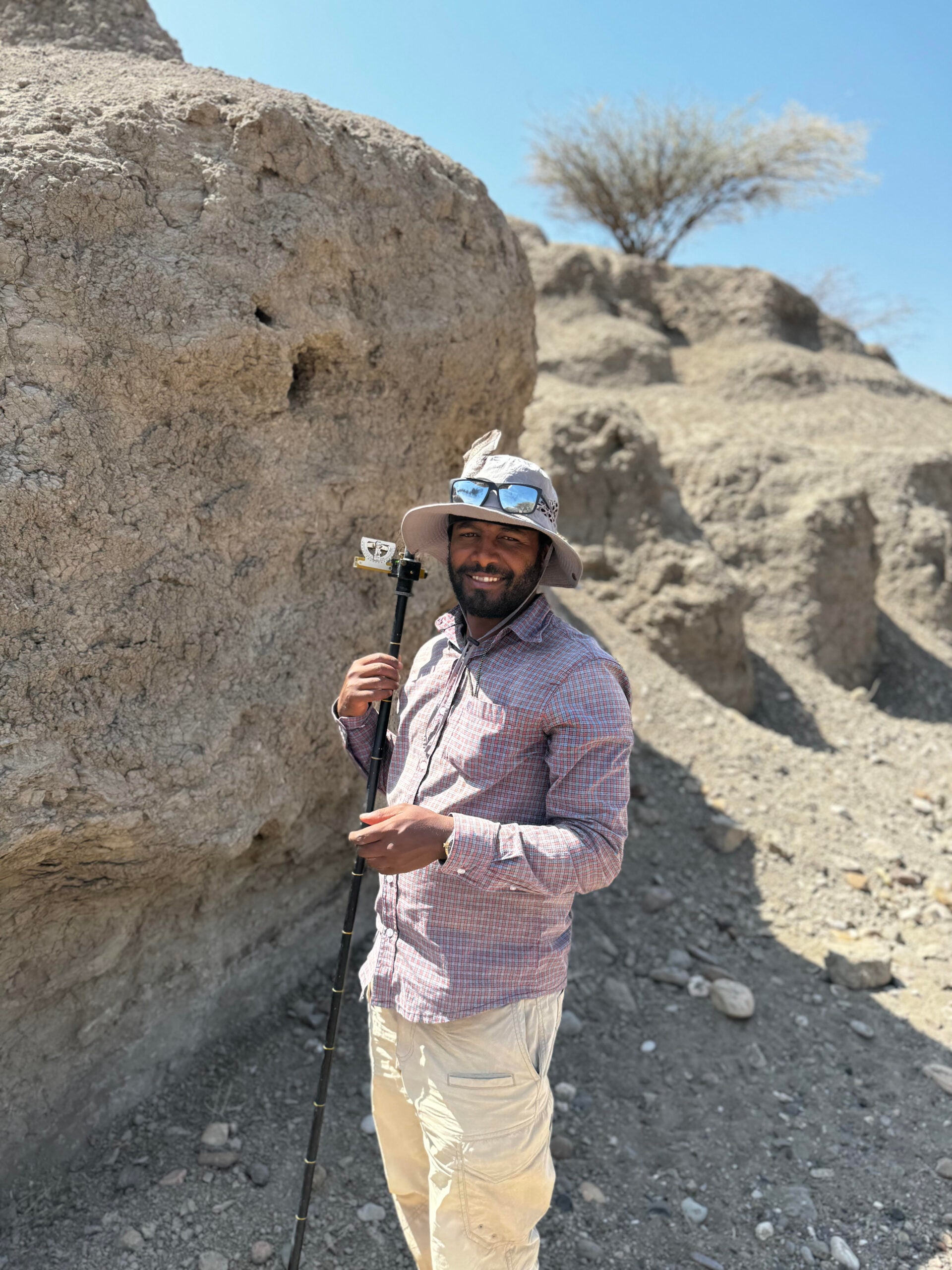
For Takele Mihretie, geology is a way to understand both Earth’s past and human evolution. Growing up in Tilili, Ethiopia, he was fascinated by the landscapes around him. After learning of the discovery of Australopithecus fossils in the Afar region of Ethiopia, his interest in geology grew and expanded to understanding how fossils are preserved in sediments and what these sediments can reveal related to human evolution. This interest led him to explore the role of geological research in reconstructing past environments to better understand their interaction with human evolution.
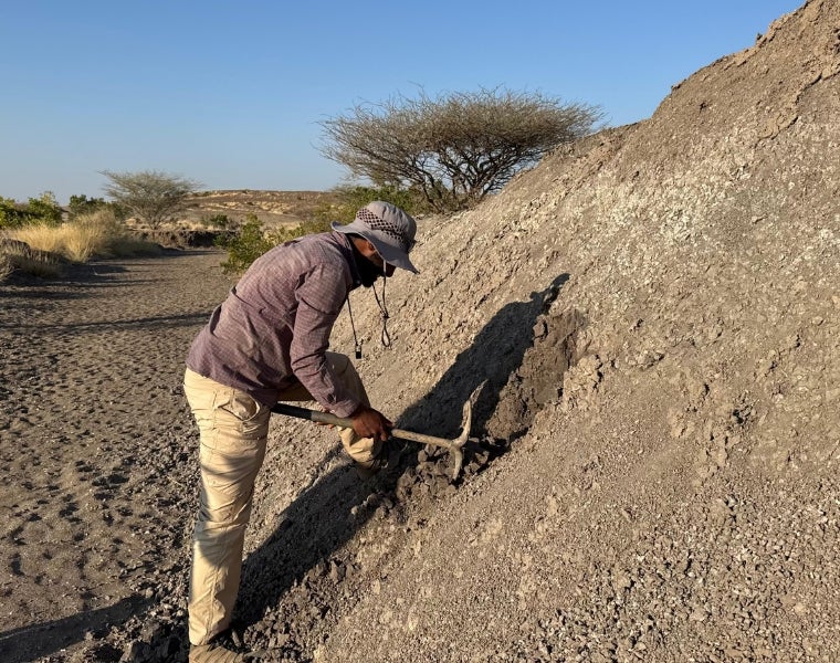
Now a graduate student at CWRU, Mihretie has returned to Ethiopia for field research as part of the Keck project under Professor Beverly Saylor and Professor Jeffrey Yarus. His work focuses on analyzing sediments and volcanic ash layers at the Woranso-Mille paleoanthropological site, which has produced some of the most significant hominin fossils ever discovered.
“Working in this area with scholars of many specific areas is the best opportunity I have ever had,” Mihretie said.
Fieldwork in the Afar region presents many challenges. The harsh terrain, extreme heat and logistical difficulties require careful planning and adaptability. During one particularly demanding expedition, Mihretie and his team used drones to create detailed 3D models of the geological setting by integrating them with geospatial analysis. With temperatures regularly exceeding 110°F, technical malfunctions were common, requiring frequent recalibrations and long trips to recharge equipment.
“The only way to settle this is not to sit idle—be patient, switch gears and work on other things in the meantime, making the most of the field time” he explained.
Mihretie hopes to continue developing high-tech methods for geological mapping, integrating AI to analyze sediment patterns and improve our understanding of past environments. His ultimate goal is to help bridge the gap between traditional geological fieldwork and modern digital analysis, making the study of Earth’s history more precise than ever before. This would also produce more accurate data for other parallel studies in areas of interest in geology as well.